
Life, 1917-09-27 · page 38 of 40
Life — September 27, 1917 — page 38: what you’re looking at
What you’re looking at
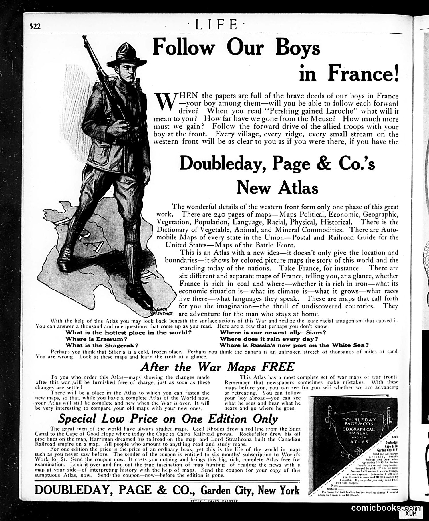
This is **wartime advertising**, not satire. Published during World War I (references to "Pershing" and the western front date this to 1917-1918), it uses patriotic messaging to sell an atlas. The illustration shows a soldier in WWI military gear—the distinctive campaign hat, rifle, and uniform mark him as an American Expeditionary Force soldier fighting in France. **The pitch**: Families with sons fighting abroad should buy this atlas so they can follow troop movements they read about in newspapers. References like "Pershing gained Laroche" and "the Meuse" are actual battle locations. The ad promises readers can visualize where "your boy" is fighting. **Secondary appeal**: The atlas also answers geographical trivia ("hottest place in the world?") and includes economic/resource maps of nations—useful information for understanding the war's causes and stakes. **The sales hook**: Free updated war maps will be provided after the war ends. This is earnest patriotic marketing, exploiting parental anxiety and national pride to sell reference books—no satire intended.
📄 Transcribed text from this page (OCR, searchable)
Machine-transcribed from the original scan — historical spelling and the odd misread are preserved.
Follow Our Boys in France! Ware the papers are full of the brave deeds of our boys in France your boy among them—will you be able to follow each forward — | drive? When you read ‘‘Pershing gained Laroche’’ what will it mean to you? How far have we gone from the Meuse? How much more must we gain? Follow the forward drive of the allied troops with your boy at the front. Every village, every ridge, every small stream on the western front will be as clear to you as if you were there, if you have the Doubleday, Page & Co.’s | New Atlas The wonderful details of the western front form only one phase of this great work. There are 240 pages of maps—Maps Political, Economic, Geographic, Vegetation, Population, Language, Racial, Physical, Historical. ‘There is the Dictionary of Vegetable, Animal, and Mineral Commodities. There are Auto- mobile Maps of every state in the Union—Postal and Railroad Guide for the United States— Maps of the Battle Front. This is an Atlas with a new idea—it doesn’t only give the location and boundaries—it shows by colored picture maps the story of this world and the standing today of the nations. ‘Take France, for instance. There are six different and | Separate maps of France, telling you, ata glance, whether France is rich in coal and where—whether 3 it is rich in iron—what its economic situation is—what its climate is—what it grows—what races live there—what languages they speak. These are maps that call forth for you the imagination—the thrill of undiscovered countries. They Weewmos are adventure for the man who stays at home. With the help of this Atlas you may look back beneath the surface actions of this War and realize the basic racial antagonism that caused it You can answer a thousand and one questions that come up as you read. Here are a few that perhaps you don't know: ee What is the hottest place in the world? Where is our newest ally—Siam? Where is Erzerum? Where does it rain every day? What is the Skagerak? Where is Russia’s new port on the White Sea? Perhaps you think that Siberia is a cold, frozen place. Perhaps you think the Sahara is an unbroken stretch of thousands of miles of sand You are wrong. Look at these maps and learn the truth at a glance. After the War Maps FREE To you who order this Atlas—maps showing the changes made This Atlas has a most complete sct of war maps of war fronts after this war will be furnished free of charge, just as soon as these Remember that newspapers sometimes make mistakes. With these changes are seitled. ¢ you, you can see for yourself whether we are advancing There will be a place in the Atlas You can follow which you can fasten the new maps, so that, while you have a complete Atias of the World now, your boy abroad—you can sce your Atlas will still be complete and new when the War is over. It will what he sces and hear what he be very interesting to compare your old maps with your new ones. hears and go where he goes. Special Low Price on One Edition Only FY gousyeoay The great men of the world have always studied maps, Cecil Rhodes drew a red line from the Suez = \ Canal to the Cape of Good Hope where today the Cape to Cairo Railroad grows. Rockefeller drew his oil MANUAL ( pipe lines on the map, Harriman d: ned his railroad on the map, and Lord Strathcona built the Canadian NY emi) empire on a map. All people who amount to anything read and study For one edition the price is the price of an ordinary book, yet this is the life of the world in maps such as you never saw before. The sender of the coupon is entitled to six months’ subscription to World's Work for $t. Send the coupon now. It costs you nothing and brings this big, rich, complete Atlas free for examination. Look it over and find out the true fascination of map hunting—of reading the news with @ map at your side—of interpreting history with the help of maps. Send the coupon for your copy of this sumptuous Atlas, now. Send: the coupon—now—hefore the edition is gone. DOUBLEDAY, PAGE & CO., Garden City, New York